Not Set
Mewstone Ledge
Cannons were found in the shallow water around the Mewstone Ledge by sports divers in the 1970s.
Type
Armed merchantman
History
The Great and Little Mewstone are small rocky islands with steep shelving faces that lie near the eastern entrance to Plymouth Sound, to the south west of Wembury Beach. From the Little Mewstone, a rocky outcrop continues some 400m towards the south west, an outcrop which is barely covered by the sea and is known as the Mewstone Ledge. The Ledge area has claimed its fair share of ships, including the paddle steamer Ajax, wrecked in 1854.
The shallow waters around the Mewstone have always been a favourite place for divers to explore, as the visibility is often good and the reef attracts a lot of fish. In 1968, Dick Middlewood from the Croydon Branch BSAC discovered two cannons lying in a gully on the Mewstone Ledge with another gun lying nearby. These guns are hard to see under the kelp, and being heavily concreted, they look like rocks; Middlewood originally thought that they were logs. At the time, he did not know what to do with the site he had found, but in 1969, Dick Middlewood and Dennis Hinchcliffe from the same diving club attended one of the School for Nautical Archaeology Plymouth (SNAP) courses run at the Royal Citadel in Plymouth by Lt Cdr Alan Bax. Dick and Dennis were inspired by the course, so they decided to set up a project to investigate the Mewstone site. Also on the course were Martin Dean and Dick Johnstone from Slough Sub-Aqua club, who were also keen to get involved, and so began a collaboration between the Croydon and Slough BSAC clubs to explore and map the Mewstone site.
The site is a challenging place to work as it consists of deep, steep-sided gullies topped with thick kelp; one gully looks very much like another, so it is not easy to find your way around. The site is also very large, covering an area of at least 75m by 50m, which made creating a site plan a laborious task. John Smart, a professional land surveyor who dived with Gwynedd Branch BSAC, also joined the team and together with Dean they surveyed the site for two weeks in August 1969. While mapping the site, they located more cannon and anchors of different sizes along with a large amount of broken coarse pink pottery. The pottery was identified as being fragments of large bi-conical jars that would have stood 0.8m high, containing 25 gallons of oil. There are so many jar fragments on the seabed that the wrecked ship was likely carrying the oil as cargo, as there would have been too many jars for the amount needed for use on board a single ship. This type of jar was originally described as Iberian or Spanish, but later research has shown that they came from Tuscany in Italy and were used to import good-quality olive oil to England. The Royal Navy was the largest single customer for table olive oil, so it is possible that this shipment was destined for use on Royal Navy ships victualling in Plymouth. The shape of the jars and the style of plaques suggest a date between 1720 and 1800, while one stamp on a jar found on the site suggests a date before 1770.
The ten heavily eroded and concreted cannons found by the team were all positioned on the site plan, and each gun was recorded in detail. All the guns were found upside down. This is often the case when a gun still attached to a gun carriage ends up on the seabed, and the wooden carriage erodes away over time. Six of the guns appeared to be 6-pounders, and four that were probably 3-pounders from between 1743 and 1780. In the muzzle of Gun26, one of the divers found the remains of the plug or tompion used to keep water out of the bore, and the tarred string pull used to remove it from the gun was still attached. Also on the site, the divers found half of a bar shot and areas of concreted cannonballs. Two anchors were found, Anchor 8 is 3m (10 ft) long, weighing approximately 460kg (9 cwt) and Anchor 5 measures just over 1.8m (6 ft) and 200kg (4 cwt). Both anchors are a typical Admiralty longshanks design with pointed crowns and straight arms, originally fitted with a wooden stock. The work done by the original team was done without the aid of modern methods and technology, but they still produced a good site plan along with a very detailed and high-quality archaeological report. The team’s efforts and methods were commendable, and in 1970, the Croydon Branch was awarded the Duke of Edinburgh’s prize for their survey of the Mewstone Ledge wreck site.
The only other find from the site was a bronze plate dated to around 1700; it was not recorded, and its current location is unknown. In a similar area, divers from Chester Sub-Aqua Club found a bronze bell with the name ‘Nillus’ on it, possibly dated to the 17th or 18th century. The bell was also kept at Fort Bovisand for some time before being stolen.
The Mewstone site was visited occasionally by sports divers, but as access was often difficult and the site was covered with kelp, it was not popular and was largely forgotten. In 2011, The SHIPS Project team found similar Mewstone pottery about 300m to the southwest of the cannon site, and this led to a re-investigation of the area in 2012. The SHIPS divers relocated the site, recorded and photographed the guns, and recovered some larger pottery fragments so the jars could be recorded in detail.
This is a condensed version of the story. For more information, please contact The SHIPS Project.
Diving the Mewstone Cannon Site
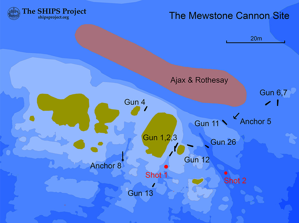
Site plan of the Ajax and the Mewstone Cannon Site by The SHIPS Project, click the image for a larger version
On the east side of the Mewstone Ledge
The shallow reef and kelp-covered gullies that make up this site create an exciting but sometimes challenging environment to dive in. At low water, the top of the reef can be just a few meters below the surface, with the gullies reaching down two or three metres in depth. The site should be dived in calm weather as any swell is accentuated by the shallow water, so divers can be thrown around in the surge. The site is also exposed to the flood tide, which can run strongly over and around the reef, so the site should be dived at slack water.
Dropping in on the shallow part of the reef, the thick kelp hides the seabed, so you must swim under it and into the gullies to see any of this wreck. Close by the shallows to the east and southeast, the reef flattens out, and further south, the reef drops away quite steeply down to 20m. Finding the site can be tricky; the cannons and anchors are badly corroded and often disguised by weed growing on them, so they may not be immediately obvious. Also, the remains of the iron paddle steamship Ajax lie to the north and overlap the site, so it's hard to tell which wreck is which. A 1.7m long round crown anchor can also be found near the site.
Last updated 26 December 2025


Information
Type:
Armed merchant ship
Date Built:
Unknown
Date of Loss:
c1750
Manner of Loss:
Wrecked
Outcome
Unknown
Builder:
Unknown
Official Number:
None
Length
Unknown
Beam
Unknown
Draught
Unknown
Construction
Timber
Propulsion
Sail
Tonnage
Unknown
Nationality
Unknown
Armament
6 pdr and 3 pdr guns
Crew
Unknown
Master
Unknown
Owner
Unknown
Reference
Hob Uid: 1527587
Finds
Finds recovered from this site include:
11A20 Jar body sherds ![]()
12A08 Jar neck fragment ![]()
12A12 Jar body sherd with ‘IF’ plaque ![]()
12A18 Jar neck (not Mewstone site) ![]()
Not Set
Leave a message
Your email address will not be published.
Click the images for a larger version
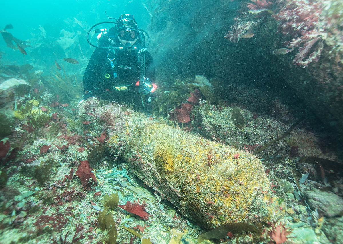

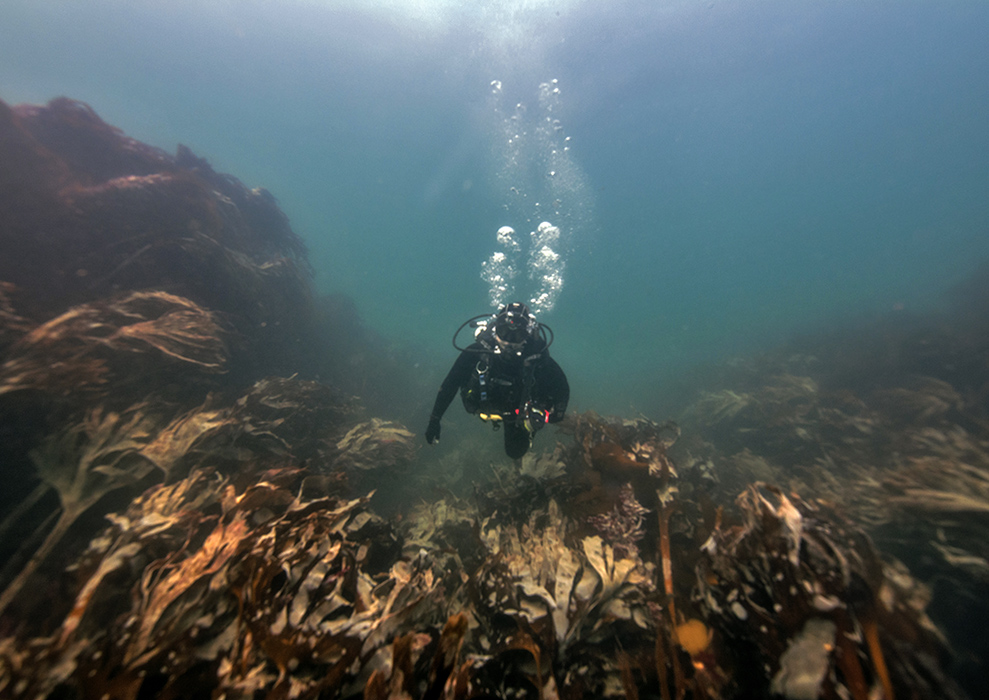
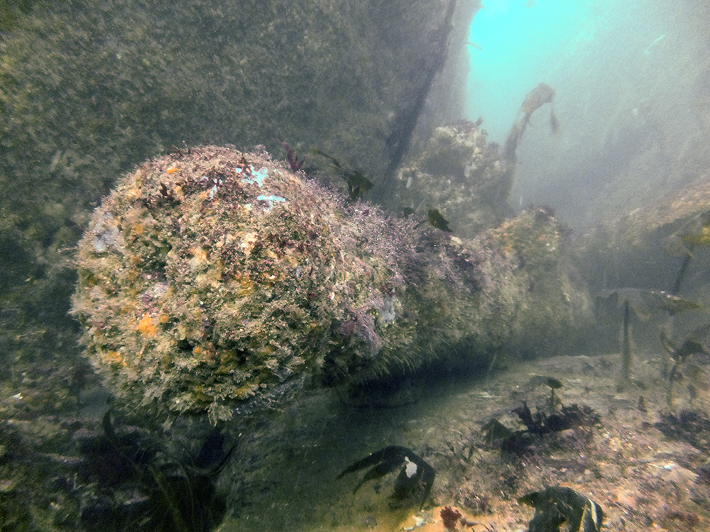
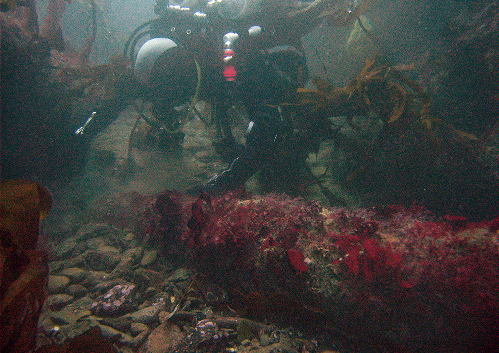
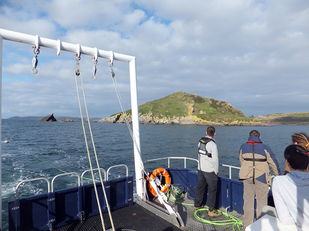
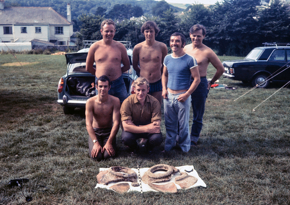
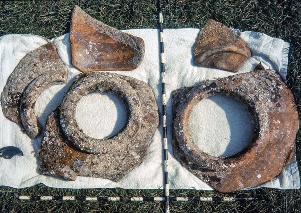
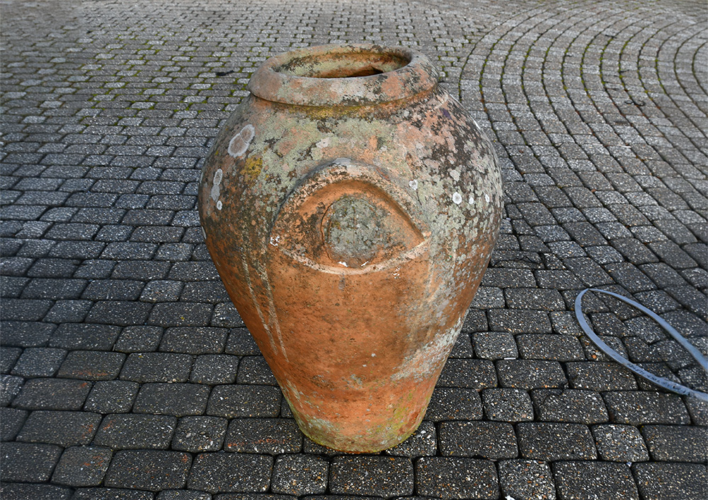
Image use policy
Our images can be used under a CC attribution non-commercial licence (unless stated otherwise).