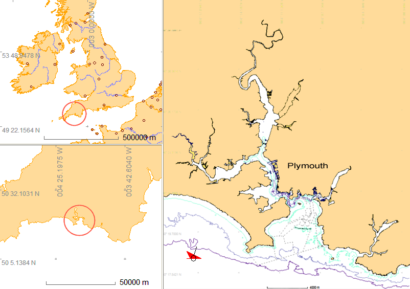
Wreck Site 1: Location
Please note that the A7 is a Controlled site under the Protection of Military Remains Act 1986 and unauthorised access to the site is prohibited.
HM Submarine A7 lies to the west of Plymouth, offshore from Whitsand Bay on the south Cornish coast.
The wreck is at position: 50° 18.527 N 004° 18.008 W (WGS84)
The site is 15km (8 nautical miles) from Sutton Harbour in Plymouth.

The location of HMS/M A7
The site is exposed from east, south and west and waves from the south-west can travel over many miles. The prevailing wind is from the south-west and the site is exposed from that direction so is affected by significant wave action. The wreck lies on a flat, soft clay seabed in 37m depth plus height of tide. The tides are directed parallel to the coastline running north-west to south-east and vice versa, with the ebb tide being the strongest. At spring tide the current reaches 1kt in an east-west direction over the site and the tide height is between 1.0m and 5.5m above LAT, a range of 4.5m. At neap tide the current reaches a maximum of 0.5 kt and the tide height is between 2.1m and 4.5m above LAT, a range of 2.4m. The time of slack water is three hours before and three hours after high water at Devonport.
Whitsand Bay is an extensively used area including recreational diving, fisheries and shell-fisheries. Underwater visibility on site varies between zero and 10m depending on weather during the preceding days. The dumping ground lies just 1400m to the east of the site so the wreck site is likely to be affected by dredge spoil dumped in the area and abandoned trawl nets may be present on the site.
Other wrecks in the area include the WW1 collier S.S. Rosehill 2.4km to the north, the frigate HMS Scylla and Liberty ship S.S. James Eagan Layne 4km to the north east and the 'Rame barge’ 3.8km to the east. These wrecks are also being investigated by the SHIPS Project.

