Project 2: Marine Geophysical Survey
Introduction
Prior to the start of this project, the current condition of the A7 was unknown as it had not been seen by divers since 2002 and the last hydrographic survey over the site was by the Royal Navy using HMS Echo in 2006.
When the submarine was first found by divers in 1914, between six and seven metres of the submarine’s stern was buried in the seabed and the bow was 10m off the bottom, raised at an angle of 30° to 40°. All contemporary salvage attempts failed and the submarine was abandoned on the seabed. Sports divers first visited the site in 1981 and found that the submarine was now on an even keel, she was largely intact but buried right up to what would be her waterline when afloat and in light ballast. The last sports divers to legally visit the site in August 2002 reported that the submarine was essentially in the same condition as it was found in 1981.
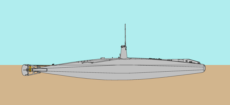
Estimate of hull attitude and burial depth based on divers' reports
Previous geophysical surveys
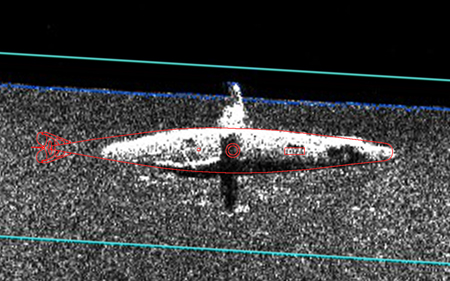
2013 side scan sonar image overlaid with the outline of the hull
The wreck was first investigated in September 1972 during a Royal Navy hydrographic survey, with the submarine showing as a 3m high target in 37m depth. The wreck was resurveyed by the Navy in 1980, the estimated height of the wreck was reduced to 2.7m and a scour 1m deep was noted on the hull lying 080°/260° on a seabed made of grey clay.
A side scan sonar survey of the site was planned as a first step in the investigation of the submarine for the A7 Project; this would provide information about the position, attitude and condition of the boat as well as information about the seabed around it. The side scan sonar uses ultrasonic sound to image the seabed, showing any objects visible on or above the seabed and giving information about seabed type and texture. On the 4th December 2013 a side scan sonar survey of the wreck was completed by Plymouth University and the SHIPS Project team using a GeoAcoustics SS981 side scan sonar transmitting signals at 410kHz. The sonar trace showed the wreck to be lying partially buried in a flat and featureless seabed, the visible part of the rounded hull 25m long and 3m wide, with the top of the hull 1.25m above the seabed and the top of conning tower 3.5m proud.
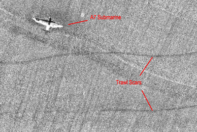
The two dark lines south and east of A7 are scars on the seabed made recently by trawl fishing
The bow of the submarine points to the north west and the aft four metres of the submarine hull, propeller, hydroplanes and rudder appeared to be buried. The sonar image showed a 1.4m long dark feature on the hull 4m forward of the conning tower which corresponds with the torpedo loading hatch (red rectangle on the right). This initially suggested that the hatch was open so the Ministry of Defence was alerted to the possibility. It was subsequently found that the hatch was shut and this was simply a sonar artefact caused by the edge of the hatch itself.
Marks or scars on the seabed were noted on the sonar record which are thought to be made by fishing trawls. The original sandy seabed around the submarine has since been covered in a thick layer of fine silt deposited during recent dumping operations on the disposal site to the east, so the seabed seen today is very recent. The presence of trawl scars suggest that fishermen are trawling within 20m of the hull and as they can still be seen this activity is likely to have happened recently.
Marine Geophysical Survey
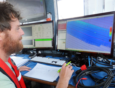
Plymouth University student Mawgan Doble mapping the A7 using multibeam sonar
Before undertaking any investigation of the site by divers, the remains of submarine A7 were mapped using the latest marine geophysical survey techniques, including side scan sonar and multibeam sonar with the assistance of Plymouth University School of Marine Science and Engineering. This work formed the subject of a Plymouth University MSc Hydrography dissertation by student Mawgan Doble; the project was well executed and the dissertation achieved a distinction mark.
In this survey an area 500m x 500m was mapped with the centre at the known position of the submarine. The geophysical survey did not include any investigations below seabed level.
On 5th June 2014, a bathymetric survey was undertaken using the Plymouth University’s R2Sonic SONIC 2024 multibeam echo sounder (MBES) system from the University’s survey vessel Falcon Spirit. The MBES prduces very detailed 3D maps of the seabed and shipwrecks using ultrasonic sonar. For wide area mapping the R2Sonic 2024 MBES was set to transmit at 400kHz while for detail recording the same instrument was used at 700kHz. GNSS augmented positioning was provided by the Fugro Marinestar XP service, which claims 10cm horizontal and 15cm vertical accuracy, and vessel attitude was measured using an Applanix POS MV Wavemaster integrated in to the R2Sonic system.
Full details of the survey methodology and results can be found in Dobles 2014 MSc Hydrography dissertation, A Site Investigation of HM Submarine A7.
3D Model
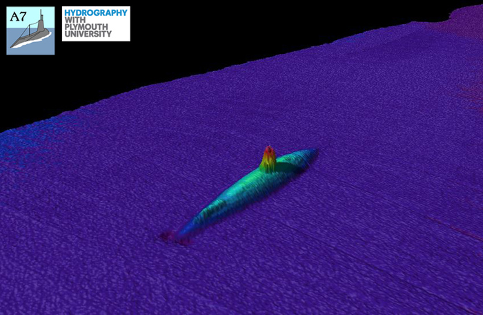
Three-dimensional model of the A7 submarine created from the multibeam sonar data, showing the submarine partially buried in the flat seabed and the small scour round the bow
The results of the high resolution (700kHz) multibeam echo sounder (MBES) survey were used to create a detailed three-dimensional model of the wreck and seabed around it. The sonar showed the submarine to be as estimated from the previous side scan survey: largely intact, upright, with bows to the north-west and buried up to her waterline. The conning tower is shown along with the remains of the cutwater on the bow and the binnacle mounting aft.
Two views of the 3D model from above and from the port side stern looking forward
Of the 30.2m length of A7 just 25.4m is visible on the surface. The deck is 1.1m proud of the seabed at the highest point near the conning tower and the tower itself extends a further 2.2m above the seabed. At the widest point on the hull the visible part of the submarine is 3.97m wide.
Bow Scour
The 3D model of the submarine and seabed recorded by the multibeam sonar clearly shows a scour pit formed around the bow, the pit is 0.3m in depth and approximately 3m wide. The scour has been formed by tidal currents flowing around the submarine and is a common feature of shipwrecks buried in soft sediments. The scour around the bow allows more of the torpedo tube shutters to be seen than would otherwise occur.

