

Searching for Whiting
Fieldwork
Survey Instruments
Data Logging: Site Searcher
Positioning: Garmin 76C DGPS
Magnetometer: Geometrics 881
Side Scan Sonar: Imagenex SportScan
Sub Bottom Profiler: SyQuest StrataBox
The geophysical survey was undertaken by the survey team between 18th and 20th May 2010 from the fishing charter boat Lady Mary of Padstow.
The position of the boat during the survey was provided by a GPS satellite positioning receiver connected to a computer that was used for recording all of the survey information. The computer showed a chart of the search area, the survey lines to be run, the position of the boat and information about what the magnetometer was measuring. The main part of the search area was completed in one morning while the second morning was spent running lines over the targets found during the first day and those found during the earlier side scan sonar survey.
The magnetometer towfish was towed on its cable behind the boat as the boat sailed up and down the survey lines. As the water was so shallow the towfish was hung underneath two floats so that it stayed close to the surface and did not get snagged on any wrecks or lobster pots on the seabed. The magnetometer detected a number of iron objects within the search area. From the size and shape of the signals it recorded we could estimate the amount of iron that was on the seabed and how far the iron object was buried.
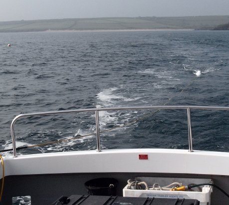
Towing the magnetometer
Side scan survey data for part of the search area was provided by Jetsteam in Feb 2010, only a low quality picture was provided but it was possible to make out a number of targets in the area covered. It is unfortunate that the most important part of the seabed around the predicted position for Whiting was not covered by this sonar survey. A good quality side scan sonar was not available for the search but we tried using a simpler one, but a fault in the tow cable meant that it could not be used.
On this survey a sub-bottom profiler was fitted to a pole over the side of the boat. Unfortunately the instrument did not detect any significant targets buried in the hard sand, picking up targets using sound in compacted sand is notoriously difficult so this result is not surprising.
Results
The geophysical survey undertaken to search for the remains of Arrow / HMS Whiting detected a number of magnetic and sonar targets within the search area.
The estimated position accuracy for the targets was approximately 5m which is accurate enough to be able to use divers to relocate the targets that were found. The main search area was completely covered by the boat during the search so it is unlikely that any targets were missed due to gaps in the data.
Although the Site Searcher program would show where the magnetometer found the targets while the survey was happening, it is usually better to process the data after all of it has been collected. Each evening back at base the data collected that day was processed and turned into targets with estimated positions and sizes.
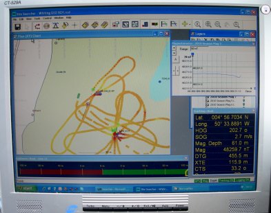
Computer screen showing magnetometer data
The results from the magnetometer survey show that it was capable of detecting magnetic targets larger than 3 tons, so there is a high probability of detecting the 20 tons of iron estimated for the Whiting’s ballast.
The side scan sonar data is incomplete as the original data provided did not cover the whole survey area and the side scan sonar to be used during the survey was faulty. This means that some surface visible non-magnetic targets in the search area may not have been detected.
The sub-bottom profiler did not detect any significant targets, this suggests that the profiler was not capable of detecting targets in this sediment rather than there being no targets to detect. Some buried non-magnetic targets in the search area may not have been detected.
Once the data had been processed the targets could be added to the site plan and put in a priority order. The targets most likely to be the Whiting because of size and location were made a high priority. Targets that were too small or too far from the estimated position were made a lower priority for investigation.
