

Padstow and the Doom Bar
The site of the loss of the Whiting is located on the Doom Bar at the entrance to Padstow harbour on the north coast of the county of Cornwall in England. Padstow lies some 50 miles to the north-east of Lands End, the most south-westerly point on the UK mainland, and is the only completely secure harbour on this stretch of coast until Avonmouth near Bristol.
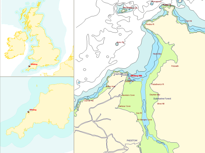 The location of Padstow with the wreck of the Whiting shown in red
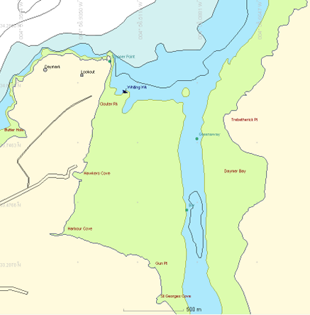
The harbour of Padstow is located within the estuary of the river Camel and is guarded at its mouth by a great sandbank called Doom Bar. The entrance is bounded by Stepper Point to the west and Pentire Point to the east. The Doom Bar has claimed hundreds of ships over the years because of the treacherous sea conditions that can be found over the sands along with the narrow and difficult entrance to the harbour. The range of tide in the harbour can be as much as 6.5 metres on a spring tide.
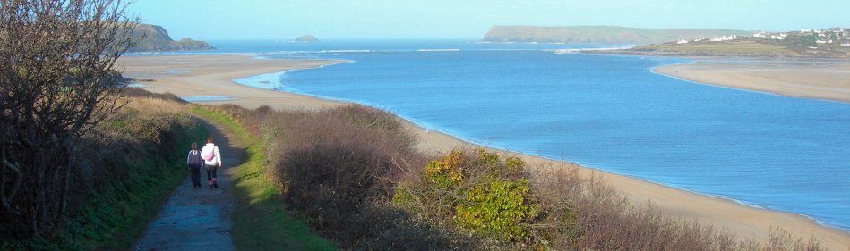
A view of the Camel Estuary from the south towards the Doom Bar
The Doom Bar
The Admiralty hydrographic chart for the area No. 1168 Padstow Harbour shows the channel entrance to the harbour towards the eastern side, however the same chart from 1839 by Sheringham shows the channel close in to Stepper Point on the western side of the estuary. At the time Whiting was wrecked the channel was on the western side and Whiting went aground on the Ketch, the most northerly part of the Bar on the eastern side of the entrance to the channel. A note dated 1930 on the 1839 chart states that 'owing to extensive alteration in the channels and banks this chart is no longer a guide to navigation', suggesting the channel shifted between 1839 and 1930. The chart created after the survey by Lt. Turner in the survey ship Beaufort 1931 shows the newer, eastern channel but also shows the older channel as a narrow cul-de-sac close in to the western shore.
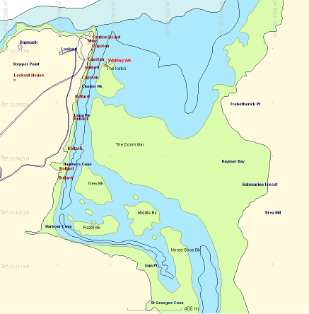
Padstow Chart 1839
Padstow Chart 2010
At the time of the wrecking the channel was reported as being 75 fathoms (137m) wide but by 1827 the effect of the wreck had reduced this to just 45 fathoms (82m) wide, causing the merchants of Padstow to petition the Admiralty to get the wreck removed. Perhaps the movement of the channel from west to east was started by the effect of the hull on the sands of Doom Bar. It may be that the lasting legacy of the Whiting was to shift the channel entrance to Padstow harbour from the dangerous route against the cliffs on the western side to the safer route to the east we have today.
