Not Set
A unknown sailing vessel abandoned at the far eastern end of Hooe Lake, possibly the ketch Alfred Rooker.
Type
Unknown sailing vessel
History
This vessel was mentioned in the book Lost Ships of the West Country by Langley & Small as one of three vessels side by side at the east end of the lake. Their map of Hooe Lake describes this as an 'unidentified barge', 'one of three vessels moored alongside each other and floating every high tide, they gradually fell into this decay'. John Cotton reported that this was the remains of the Millbrook passenger ferry Cornubia but does not state his source.
Further research in 2021 has shown that the hulk Hooe Lake 4 ![]() may be the remains of the ketch Alfred Rooker
may be the remains of the ketch Alfred Rooker ![]() (Fig. 1), see Hooe Lake Mystery Ships
(Fig. 1), see Hooe Lake Mystery Ships ![]() for more information.
for more information.
Description
The lower part of the vessel is all that remains, including keel, part of the sternpost, lower frames, inner and outer planking and stringers (Fig. 2).
This vessel is currently being investigated and recorded by The SHIPS Project with the intention of identifying the type and name of the vessel. A detailed archaeological report on this and the other hulks we investigated is currently being written. A detailed archaeological report on this and the other hulks we investigated is currently being written.
Location and Access
Hooe Lake, Oreston, Plymouth
From Oreston, take the Lower Saltram road off Plymstock Road then turn right into Kingfisher Way. Follow the road down to the lake and there is a car park at the end. The wreck partially covers at high tide springs so plan a visit to coincide with low water, the foreshore is accessible when the tide height is less than 2.5m above chart datum. The foreshore round the wreck is soft mud so appropriate footwear is needed.
Nearby hulks include the lighter Arthur ![]() , the fishing boat Hooe Lake 1
, the fishing boat Hooe Lake 1 ![]() , Brixham trawler Wendew
, Brixham trawler Wendew ![]() , unknown vessel Hooe Lake 3
, unknown vessel Hooe Lake 3 ![]() , the passenger ferry Cornubia
, the passenger ferry Cornubia ![]()
Last updated 03 Jan 2021


Information
Date Built:
Unknown
Type:
Unknown
Builder:
Unknown
Official Number:
Unknown
Length
21m / 69ft
Beam
Depth in Hold
Unknown
Construction
Timber, carvel
Propulsion
Sail
Tonnage
Unknown
Portmarks
Unknown
Outcome
Abandoned before 1980, partly broken up
Reference
Unknown
Margaret Jarvis
My grandfather used to go out at low tide in the 50’s and get wood for his fire, it burnt with a lovely blue flame. Our family home overlooked the lake.
Not Set
Leave a message
Your email address will not be published.
Click the images for a larger version
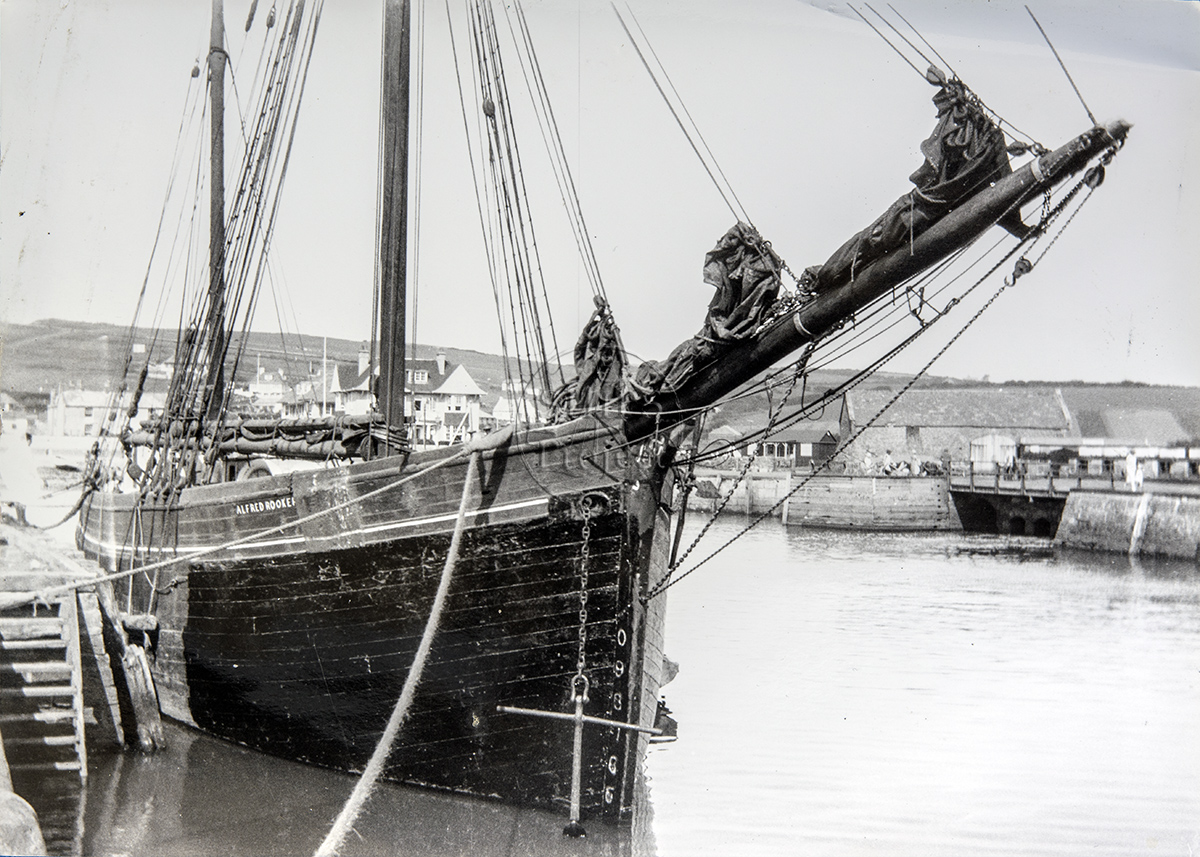
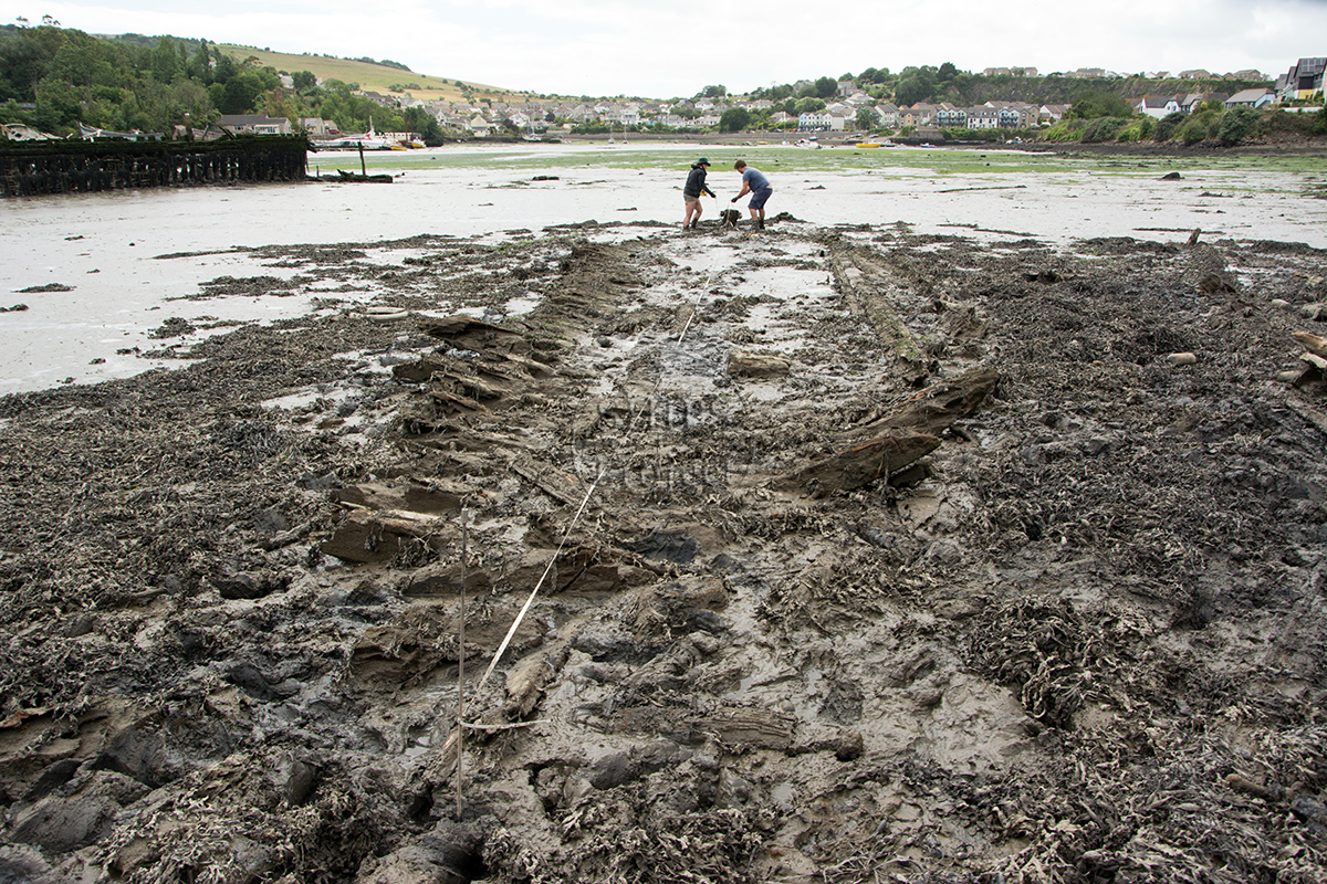
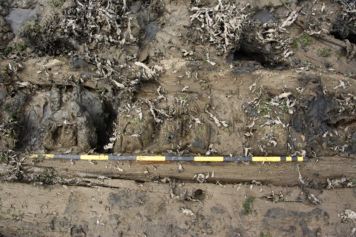
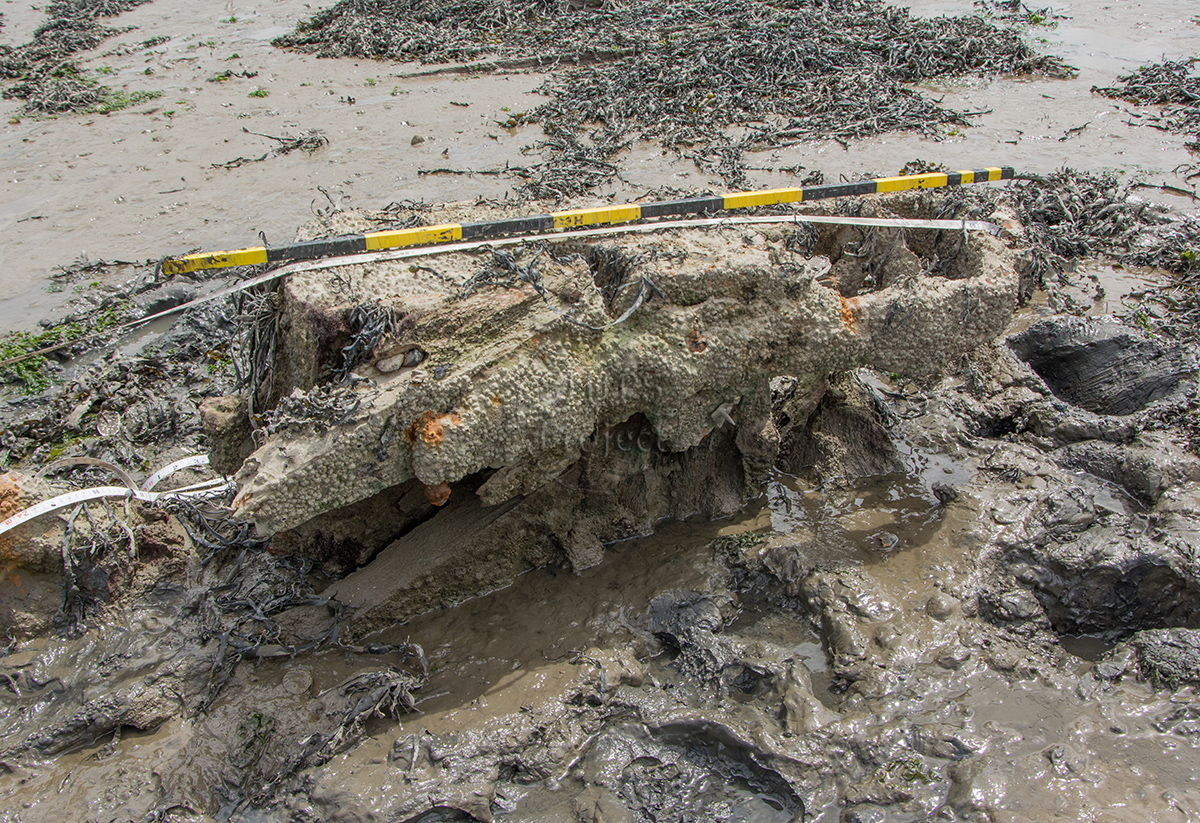
Image use policy
Our images can be used under a CC attribution non-commercial licence (unless stated otherwise).