Not Set
The Greek brig Taxiarchos ran into Rame Head at high speed in thick fog in January 1843.
Type
Greek brig
History
In January 1843, the Greek brig Taxiarchos was on a voyage from the River Danube to Hull with a cargo of bones. The master, Carlo Vafrapola, needed assistance to navigate the English Channel, so they stopped in Falmouth to pick up a pilot from St Mawes. The ship left Falmouth on the evening of 27th , the wind was blowing a fair breeze from the west, ideal for their voyage, so they set all sail including studdingsails to take advantage of the favourable wind, despite the hazy conditions. The pilot checked that the ship was on the correct southeast course and went below to get some sleep, with orders to wake him for his watch at midnight. Somehow the course was altered by mistake to northeast and the fog got thicker. Just before midnight, the ship ran hard aground on the southwest corner of Rame Head in what was by now thick fog. Only one man was injured in the collision and they were extremely fortunate with their location because they could easily scramble ashore up a grassy bank, had they hit just to the west or east they would have run into steep cliffs. The crew took shelter in Rame Chapel on the top of the headland, they were found by a coastguard officer from Polhawn, Mr Foot, who tried to get them to the Coastguard Station. The crew refused, so instead he brought them coffee, spirits and straw to make a bed. Once recovered from their ordeal, Mr Foot took them to a local pub where they would be looked after and he found a doctor to tend to the injured man.
The vessel broke up quickly where she lay and were scattered on the seabed close inshore all around Rame Head. The cargo of bones was lost to the sea, some of the crew’s clothing was saved along with a small portion of the vessel’s stores. The stores were sold so the money could be used to pay for the crew’s food and lodging until they were repatriated. A box containing money and valuables that was supposed to have been owned by the master of the Taxiarchos was found off the Yealm a day later. Since she was a relatively new vessel, the loss was felt to be very severe, The Falmouth pilot blamed the navigation compass, a safe claim for him because they were never recovered. The pilot was chastised by the local newspapers for the loss, the Herald even suggesting that he should obtain a copy of the Remarks on the Navigation of the English Channel!
The remains of the ship were rediscovered in the summer of 1982 by local Plymouth diver and photographer, Dave Peake. While snorkelling around the rocky headland at Rame, Peake noticed an old round crown anchor on the seabed though the kelp, it was badly worn and partly buried, but unmistakably an anchor. He then spotted two more anchors lying about 5m apart in a nearby gully, both larger than the first, these anchors measured 2.5m in length and had large arrow-shaped flukes. Peake noted that the surrounding seabed was strewn with other iron wreckage including an iron spindle and drums from an anchor windlass. He presumed that after the ship ran into the rocks, the bow settled and rotted away, thus leaving the foredeck gear and anchors. We now know that the ship broke up shortly after it sank leaving just the iron and brass fittings on the seabed. Eleven years later, Peake returned to the site with diver Paul Bailey and Alan Down, to see what else could be found, and it was then they discovered the ships bell partly buried in the seabed. Unfortunately, after over a century underwater, the eroded bell no longer bore the name of the vessel from which it came and a hole had been worn right through on one side. However, it was determined that the bell and anchors most likely belonged to the same ship as they were so close together, Peake started to research the wrecks on Rame Head and came to the conclusion that he had found the brig Taxiarchos lost in 1843.
Diving the Taxiarchos
The site is best reached by boat but can also be reached by hiking down the hillside from Rame Head. The anchors and iron fittings lie very close inshore at the bottom of a gully running east-west in a few metres of water at low tide. The site is very scenic, there are deep gullies topped with kelp and shingle seabed, the place is a haven for fish and crabs, and on a bright day with good visibility is a fabulous place to take photographs.
By boat the site should be dived at high water, the seabed rises steeply to Rame Head so the boat can be brought quite close in, but an echo sounder must be used to check the depth under the keel when approaching the site. Only dive this site in calm conditions and preferably with only gentle winds from the north, the site is completely exposed to the south and any waves or swell make diving conditions unsuitable.
Last updated 19 Mar 2026


Information
Date Built:
Unknown
Type:
Brig, sailing ship
Builder:
Unknown
Official Number:
Unknown
Length
Unknown
Beam
Unknown
Draft
Unknown
Construction
Timber
Propulsion
Sail, brig rig
Tonnage
300 GRT
Nationality
Greece
Crew
14
Master
Captain Carlo Vafrapola
Owners
Unknown
Voyage
River Danube to Hull
Cargo
Bones
Portmarks
None
Date of Loss
27th January 1843
Manner of Loss
Wrecked
Outcome
Abandoned
Reference
HOB ID 922297
.
Not Set
Leave a message
Your email address will not be published.
Click the images for a larger version
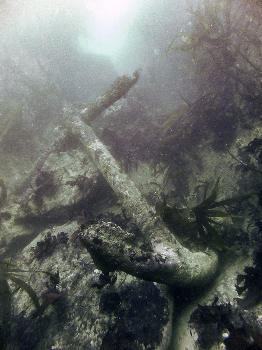
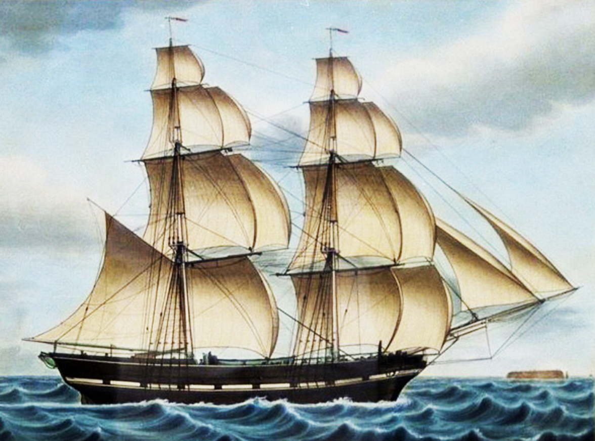
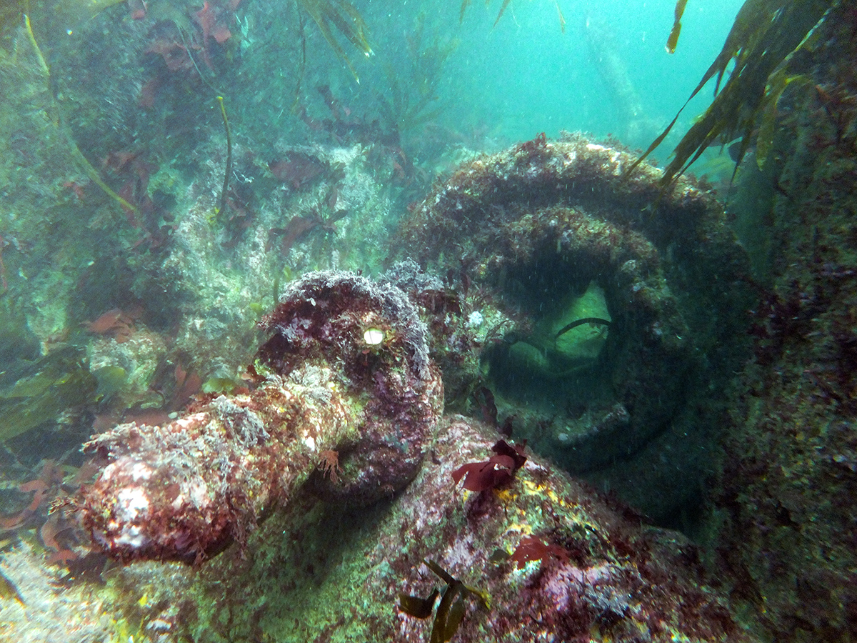
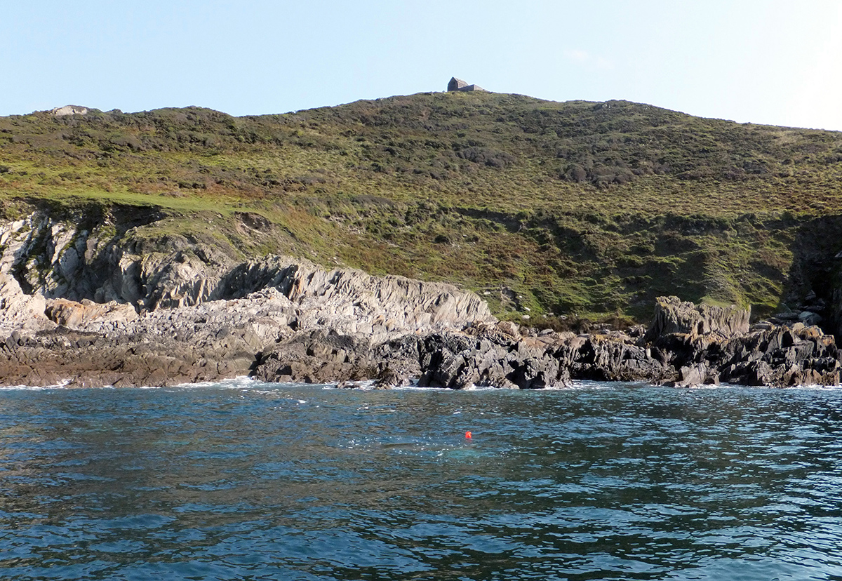
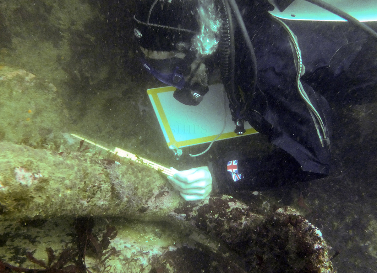
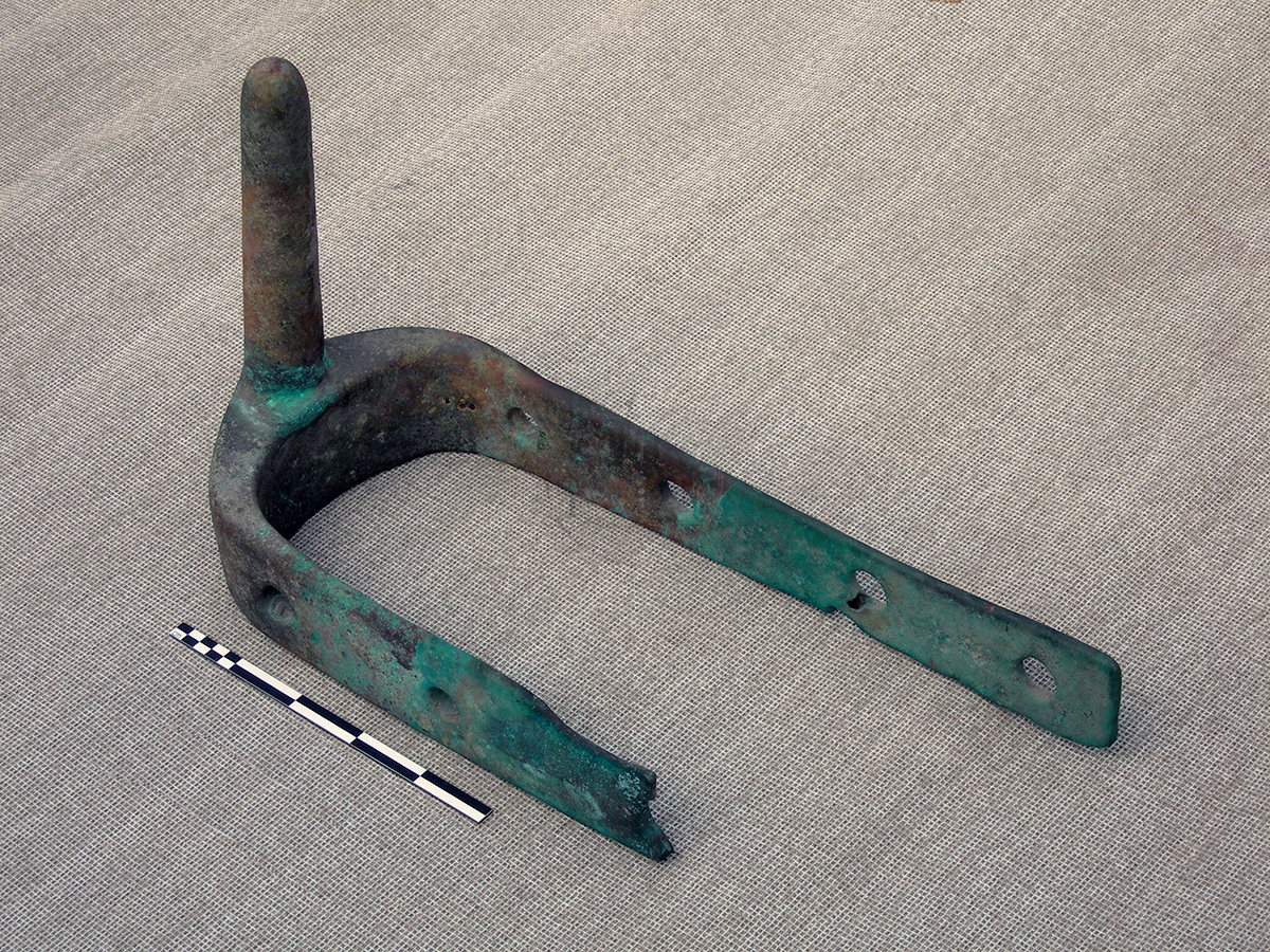
Image use policy
Our images can be used under a CC attribution non-commercial licence (unless stated otherwise).