Not Set
Remains of two steel vessels abandoned by Laira Bridge, Plymouth.
Type
Unpowered steel barge (1) and unknown (2)
History
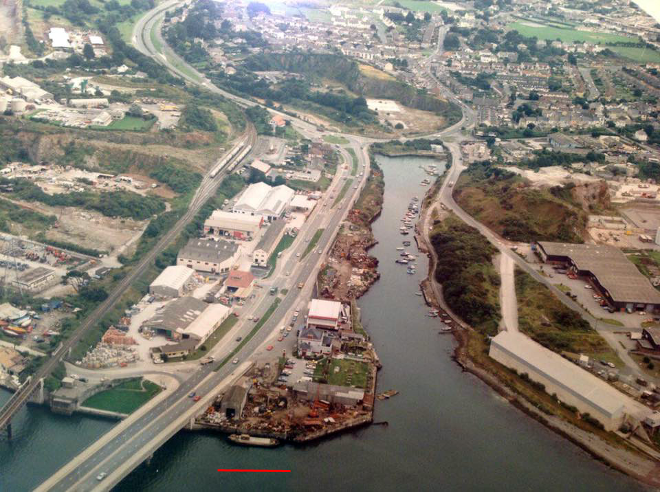
The remains of two vessels can be seen alongside the old Coles timber merchants wharf between Laira Bridge and Pomphlett Creek. The wharf used to be the location of one of the Davies & Cann shipbreaking yards and the vessels are the remains of some of the last ships to be broken up there.
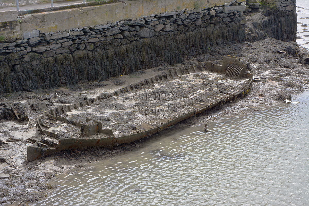
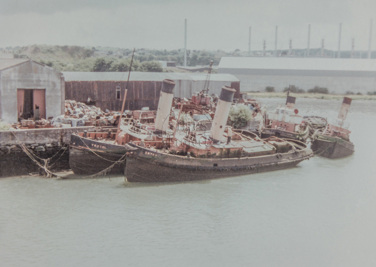
The last four W.J. Reynolds Ltd. coal-fired tugs were broken up there. When Cory Ship Towage took over Reynolds' goodwill and contracts the four remaining tugs were take on charter for a short period before being replaced. The Trevol (ex-Reagarth), Tactful (ex-Tolbenny), Carbeile (ex-George Livesey) and Antony (ex-Corgarth), the last steam tugs on south coast, sold in May 1979 to Davies & Cann Ltd. and scrapped in 1984. The larger barge must have been scrapped after that date as it is in the same berth as the tugs had been (Fig 5).
Davis & Cann also owned Martin’s Wharf between power station and Laira bridge on the west bank of the Plym. The scrapyards were sold in 1993.
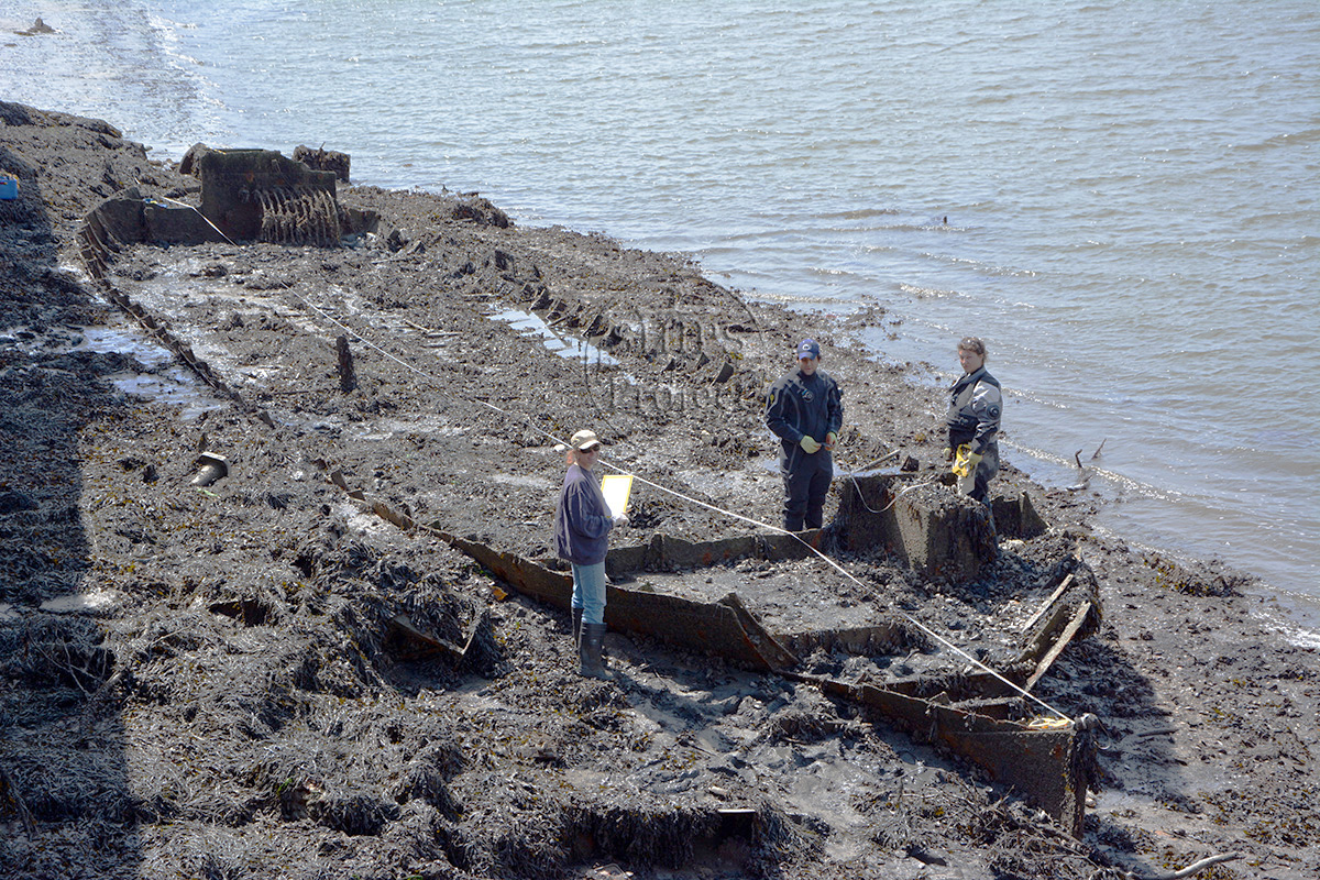
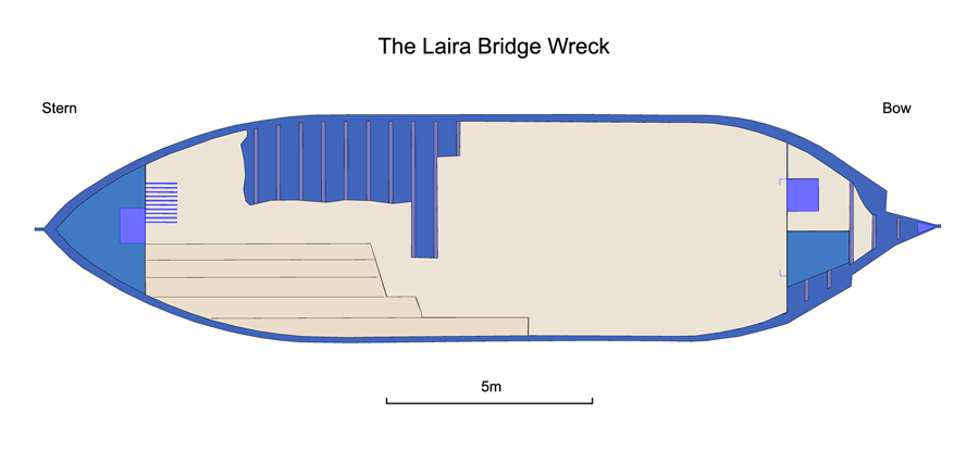
In 2014 Laira Bridge 1 was used by The SHIPS Project for experiments in shipwreck recording and in ultrasonic hull thickness measurements, see Mapping the Laira Bridge Wreck ![]() on the 3H Consulting website (Fig 3).
on the 3H Consulting website (Fig 3).
Description
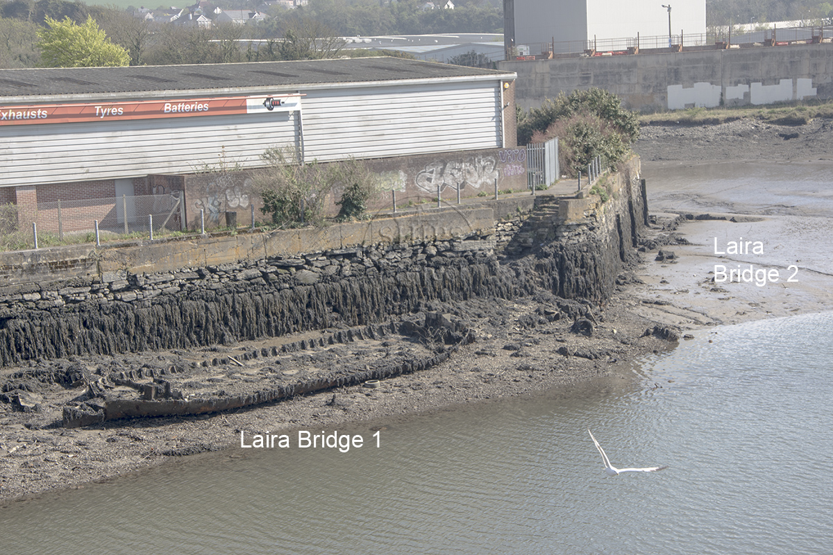
Barge 1 is visible (Fig 1) while another to the south is almost completely buried in the riverbed (Fig 4). Barge 1 is 22m long and 5.5m wide constructed from rivetted steel, with a flat bottom and no engine, the remains include the lower frames and hull plating, bulkheads and dunnage planking. Barge 2 is also steel but may have been powered as it has a flat transom stern; the hulk is completely buried so no further details are available.
There are still some Victorian naval bollards in-situ along the quay, which may have been liberated from the dockyard. A similar steel barge has been used as the foundation for the slipway at the boatyard that now occupies the Martin's Wharf site on the opposite side of the river Plym.
Location and Access
East bank of Laira Bridge, south side.
The barges can be seen at low tide from Laira bridge. The wharf can be accessed via the path that runs between the ETB workshop and Laira Bridge and there are steps leading from the path down to the foreshore.
Nearby hulks include Cattedown 1 ![]() , Prince Rock 1
, Prince Rock 1 ![]() , Baltic Surveyor
, Baltic Surveyor ![]() , the Plym dredger
, the Plym dredger ![]() and the Ocean Maid
and the Ocean Maid ![]()
Two similar steel barges are being used as the foundations for a slipway, see Oreston 1 & 2 ![]()
Last updated 01 May 2021


Information
Date Built:
Unknown, 1940's?
Builder:
Unknown
Official Number:
None
Length
(1) 22m (72ft)
Width
(1) 5.5m (18ft)
Depth in Hold
Unknown
Construction
(1) Steel, rivetted, (2) Steel
Propulsion
(1) None, (2) Unknown
Tonnage
Unknown
Portmarks
None
Outcome
(1) Partially scrapped between 1984 and 1993, (2) unknown
Reference
Unknown
Not Set
Leave a message
Your email address will not be published.
Click the images for a larger version