Exploring Maritime Plymouth
The SHIPS Project was started by divers who were exploring the sea and estuaries around Plymouth. With is long maritime history and huge number of shipwrecks of all ages, there is much to be discovered in Plymouth Sound.
Discovery of a new underwater site often starts with a clue suggesting there may be something to find. The clue may be a tale told by a diver about something they had seen or recovered from the seabed, it may be a target identified during a geophysical survey or historical records may suggest that a shipwreck happened in a particular location. Sometimes discoveries are made accidentally during a dive in a new area just to see what's down there.
Diver's Tales
Sports divers have been exploring the seas around Plymouth for as long as sport diving has been possible. The clear water, sheltered bays, wonderful marine life and abundant shipwrecks have drawn divers to explore the seas since the 1950s. The early divers told stories of what they found in dive magazines and books, but some are still around and give us rare eyewitness accounts of what they and their friends discovered. Often they recovered what they found and sometimes the rare or unusual objects have been kept by the diver. These finds are recorded and photographed by the SHIPS team then published on this website or in books or papers. The old divers tell stories about well-known shipwrecks they dived in the early days which give us clues about them and tell us more about how the site has changed over the years. The divers also tell us about parts of shiopwrecks or cannon and anchors that they found, sometimes they are not previously recorded so the SHIPS divers go off to investigate. The divers' stories are an important part of Plymouth's maritime history so we make audio or video recordings of as many as possible.
Research
Many people have studied the history of Plymouth and the stories of the ships that were wrecked around its harbour. The events they recorded left traces on the seabed and foreshore and it is those traces that the SHIPS team have been finding. A book may suggest that a particular ship was wrecked in a particular place and the team would go there to see if anything remains. Tthe SHIPS divers may find something unusual on the seabed then go back to the archives to see if they can find out what they have found or where it came from. The SHIPS team has researchers that uncover information that the dive team can then follow up, combining those with a love of historical research with people with a love of exploration.
The SHIPS Project also provides a home for researcher's archives. Many people have a love of the sea or maritime history and they may research the subject in detail. These private documentary archives are often the only place where such information has been recorded so they are very important, so we provide a home for them when they are no longer wanted. Older archives are often on paper so we digitise the documents, make digital copies of photographs and slides. Once in digital form we can copy and share the information more widely and add the details to our existing records of shipwrecks, hulks, places and historical events.
Geophysical Surveys
Another way of finding the remains of our underwater heritage is to go looking for it with electronic instruments. There are a range of tools available, each providing different information, but when the data from them is processed they provide clues about man-made objects on the seafloor that the SHIPS divers can investigate. These instruments are often expensive to rent or buy and require an expert to use them so the SHIPS team has joined up with a number of organisations and companies who can collect the survey data for us. Our primary partner in survey work has been the hydrographers at the University of Plymouth, they have been providing us with suvey data since 1993, but we have also had a lot of help from commercial companies like Sonardyne International, Geometrics, Swathe Services and Ultrabeam Hydrographic.
There are a number of tools deployed to find shipwrecks. Multibeam sonar can be used to create a 3D model of the seabed showing the shape and texture of the seabed material. Side scan sonar creates an image of the seabed which can show fine detail of any man-made objects, but also shows the texture and nature of the seabed. A sub-bottom profiler uses sonar signals to penetrate soft sediments like sand and mud and can detect objects that are buried within it. A magnetometer measures the Earth's magnetic field and can be used to detect iron objects on or buried in the seabed. These instuments are deployed from boats which sail over an area to be surveyed, the data from the instruments is recorded on computers then processed in the office. Each survey produces a list of targets and their positions which are the added to the geographic Information System (GIS), a large mapping database containing all the information we have about the seabed and foreshore around Plymouth.
Most often the survey work is done from survey boats about 10m long but for shallow water work we fit the geophysical instruments to smaller inflatable boats. We also use autonomous surface vehicles (ASVs) to collect data in shallow water and autonomous underwater vehicles (AUVs) for deeper water.
When Something Is Found
When a geophysical survey or a diver's story gives us a new place to explore the first thing to do is collect together all the information we have on that subject. Using all the data we decide where to start exploring then brief the dive team so they know what they should be looking for. The divers go out and explore the area then go through a standard set of procedures for when something is found, they mark the position with the help of the boat crew, the record what is found, photograph it or record it on video, then take notes underwater of what they saw. This information is brought back to the boat and used to brief the next team of divers who can carry on the search. The information recorded during the dive is brought back to the office, processed, added to the GIS and archived.
Most often we use experienced sports divers for exploration work but sometimes use remotely operated vehicles (ROVs) for searching or where the water is deep and dive time is limited. For deeper shipwrecks we work with teams of divers who are qualified and experienced in exploring in deep water, as that requires additional training and more expensive and complex diving equipment. When we do an archaeological excavation of a site that requires excavation skills we use a mixed team of professional archaeologists and our own divers. Foreshore work can include far more people as no diving skills are required, just an interest in maritime heritage and not minding getting very muddy.
Sometimes we work with other groups to explore targets on the seabed or on the foreshore. We train the divers in the methods to use for searching, positioning and recording then share information about which targets to dive and what was found. The SHIPS Project is a big collaborative effort that works because of support from the diving, heritage and academic communities.
Training Volunteers
We provide training to local diving groups how to locate and investigate targets underwater, and to teams of people wishing to investigate hulks and other heritage on the foreshore. We also train people to record and photograph objects found underwater, or how to look after things found on the seabed or on the foreshore.
Public Awareness and Outreach
We tell people about what we do and what we have found using this website and through social media. We also include the information in books and professional publications and in presentations at academic conferences. Social media is a great way to tell thousands of people about what we do, but it also helps us by providing information we otherwise would not be able to find out. For the foreshore hulks project we posted information about what we knew about boats abandoned on the foreshore and many people would comment on the posts by telling us more about them, or that their family was associated with them in some way. Using social media we can find out information that is not written down anywhere and is only in the memories of a few people.
- Information about shipwrecks around Plymouth can be found here
 .
. - Information about foreshore hulks around Plymouth can be found here .
To get in touch with The SHIPS Project please send us a message below:
Leave a message
Your email address will not be published.
Click the images for a larger version

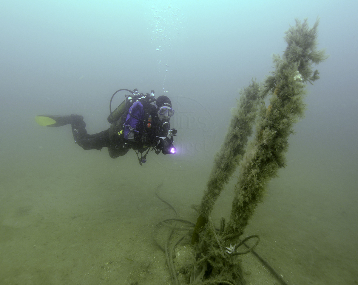
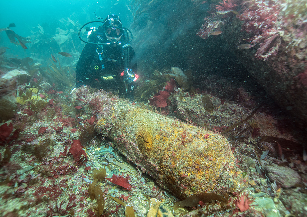
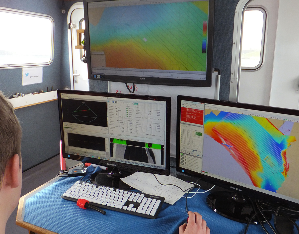
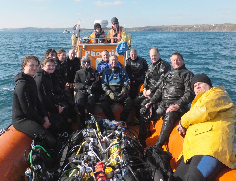
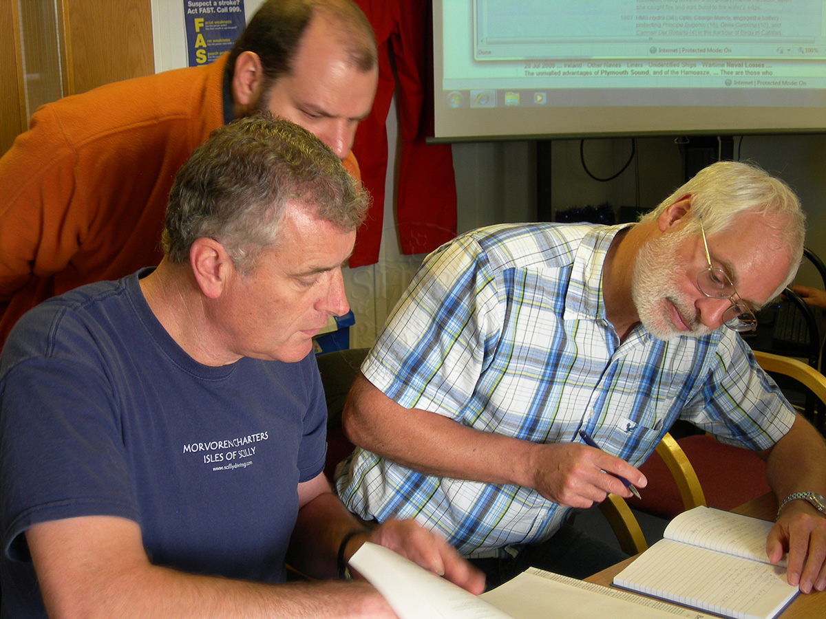
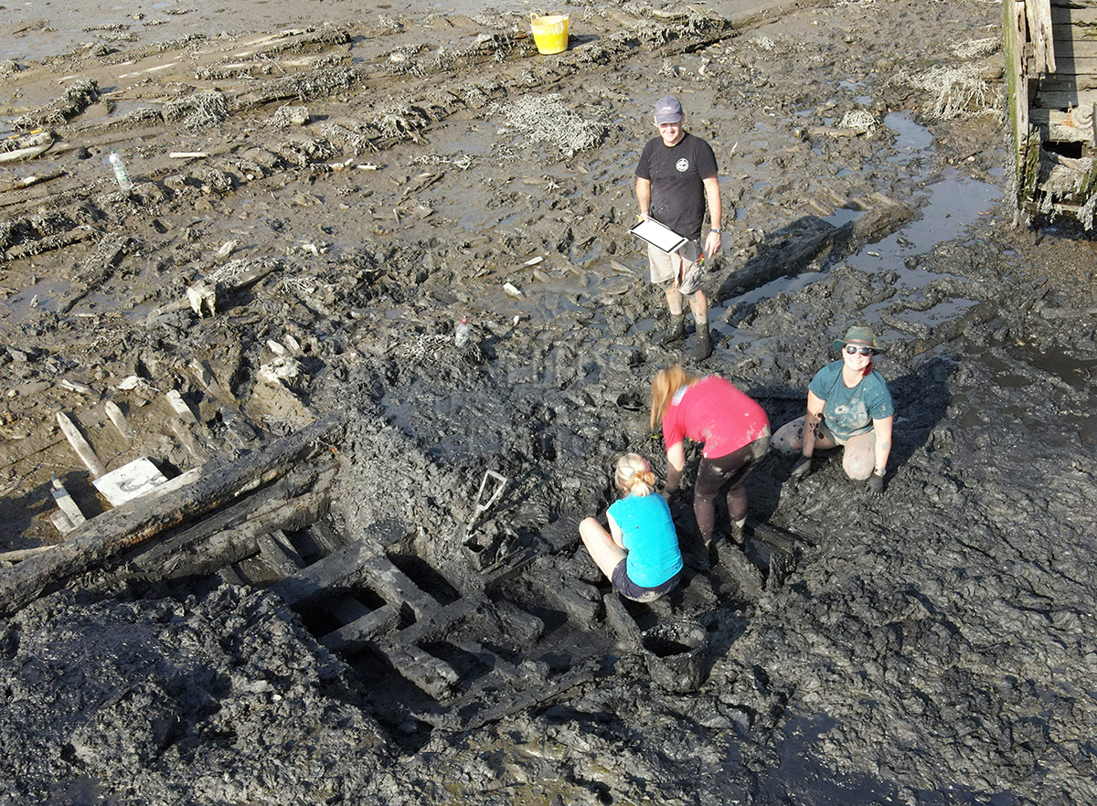
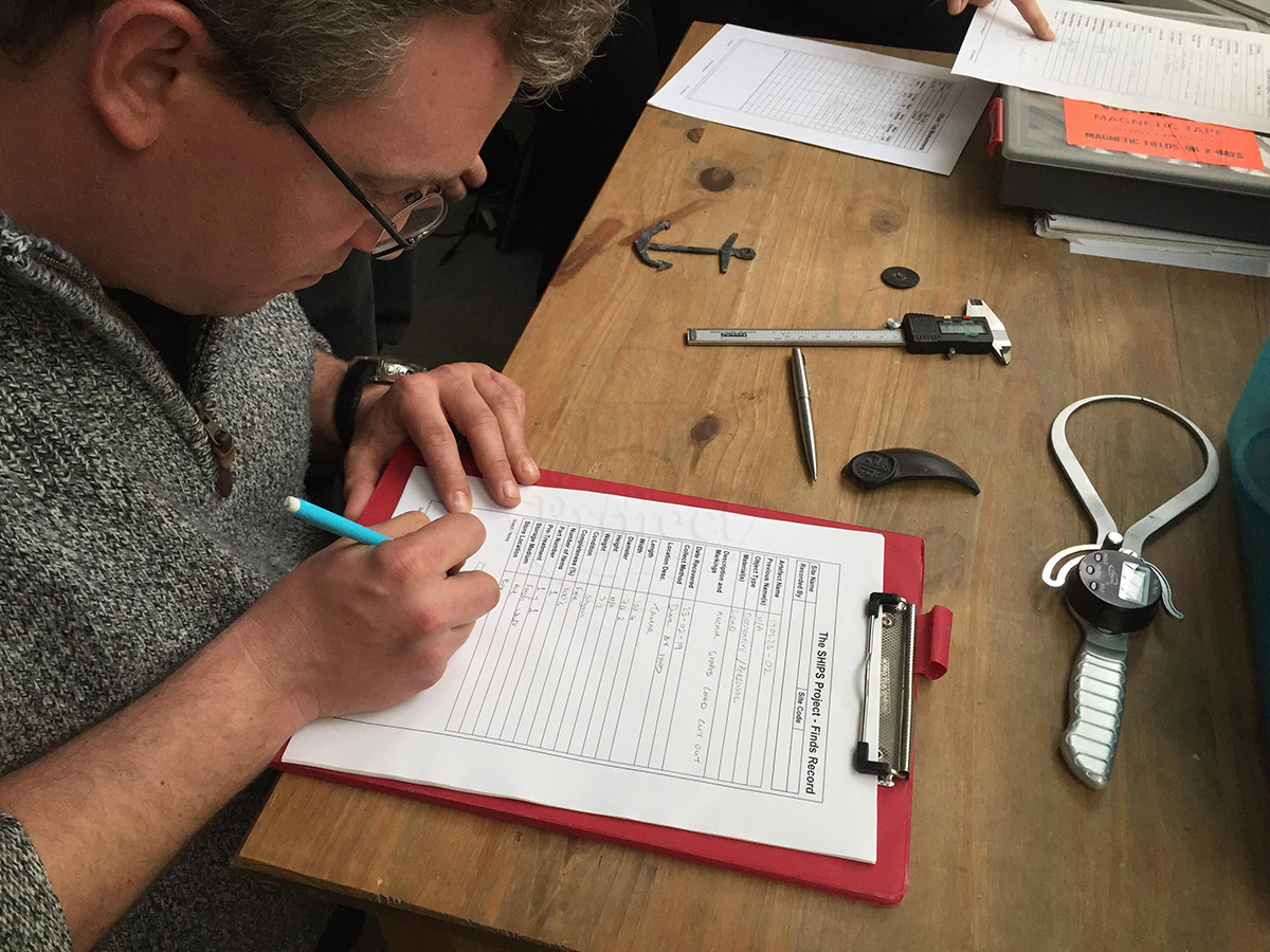
Image use policy
Our images can be used under a CC attribution non-commercial licence (unless stated otherwise).