Not Set
The remains of a boat on the foreshore at Antony Passage once thought to be a Royal Navy picket boat but it has been identified as the Tamar sailing barge Elizabeth Jane.
Type
Tamar sailing barge
History
Jan Carpenter has indentified this hulk as the remains of the Tamar sailing barge Elizabeth Jane of 50 tons, who worked with similar vessels Lynher ![]() and Triumph
and Triumph ![]() hauling stone from Poldrissick Quarries. Ian Merry has little to say about this barge other than she was "one of the few little barges able to reach Tideford Quay". Figure 1 shows the Elizabeth Jane at Kilna Quay, Tideford, discharging cargo.
hauling stone from Poldrissick Quarries. Ian Merry has little to say about this barge other than she was "one of the few little barges able to reach Tideford Quay". Figure 1 shows the Elizabeth Jane at Kilna Quay, Tideford, discharging cargo.
Langley and Small in their book Lost Ships of the West Country included a note that the remains of a Royal Navy picket boat can be found on the foreshore at Antony Passage. The vessel is reported to have been bought by a local resident for private use but was then abandoned and left to fall apart. This account more likely refers to the Steam Pinnace ![]() in the mill pond a few hundred metres to the north. The larger barge in Forder Creek identified as the Lord John Roberts or George Murray
in the mill pond a few hundred metres to the north. The larger barge in Forder Creek identified as the Lord John Roberts or George Murray ![]() has also been erroneously identified as the Elizabeth Jane in a number of documents.
has also been erroneously identified as the Elizabeth Jane in a number of documents.
The remains of a wooden vessel can be found on the foreshore and was photographed by The SHIPS Project in 2017, but little now remains and further investigation is required to be able to identify the type of vessel.
Please get in touch if you have any information about this vessel by sending us a message below.
Description
The heavily eroded remains of a keel and some timber frames with iron fastenings can be seen on the foreshore, hidden by weed (Figs 2 - 4).
Location and Access
Antony Passage, to the east of the harbour.
From Forder, follow the road to Antony Passage. The remains of the vessel can be found on the foreshore 80m to the east of the harbour wall.
Nearby hulks include Lord John Roberts ![]() , Trawler Boy Eric
, Trawler Boy Eric ![]() , the Steam Pinnace
, the Steam Pinnace ![]() and the Landing Craft
and the Landing Craft ![]()
Last updated 16 May 2021


Information
Date Built:
Unknown
Type:
Tamar sailing barge
Builder:
Unknown
Official Number:
Unknown
Length
Unknown
Beam
Unknown
Draft
Unknown
Construction
Timber, iron fastened
Propulsion
Unknown
Tonnage
Unknown
Portmarks
None
Outcome
Abandoned before 1990
Reference
Unknown
Not Set
Leave a message
Your email address will not be published.
Click the images for a larger version
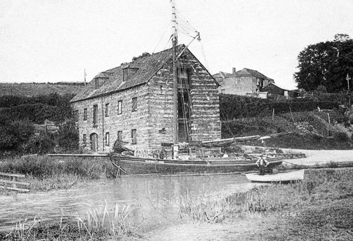
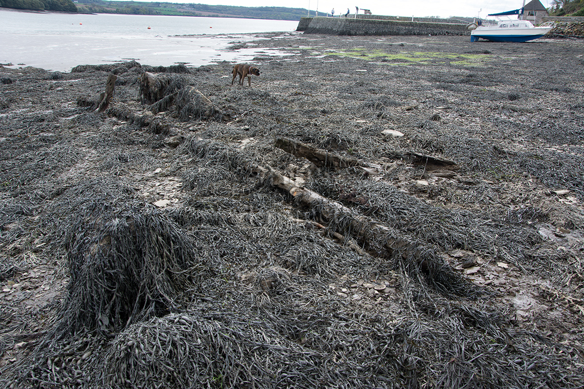
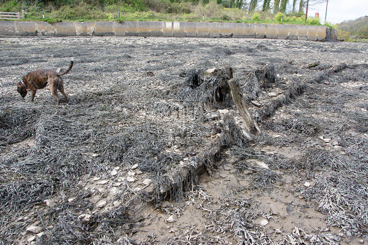
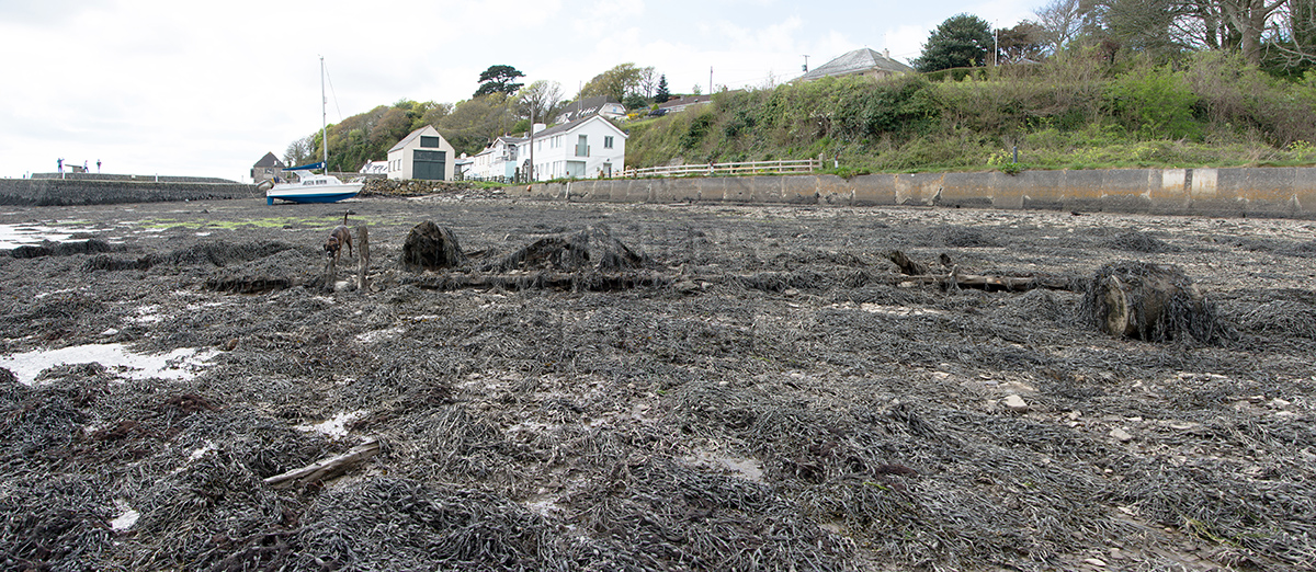
Image use policy
Our images can be used under a CC attribution non-commercial licence (unless stated otherwise).